





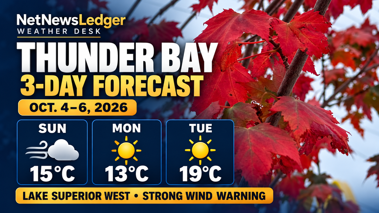
THUNDER BAY – WEATHER – Sunday, Oct. 4, 2026: Thunder Bay is set for a breezy Sunday, with sunny skies returning on Monday and temperatures warming up by Tuesday. A strong wind warning is in place over western Lake Superior, with northwest winds expected at 25 knots today and tonight.
Thunder Bay: Three-Day Forecast for Oct. 4-6
Sunday, Oct. 4: Cloudy Skies and Strong Northwest Winds
Today will mainly be cloudy with a 30 per cent chance of morning showers. Northwest winds will pick up to 30 km/h, gusting to 50, bringing an afternoon high of 15°C. The UV index stands at 3, which is considered moderate.
This evening, skies will clear after midnight. Winds should calm down around that time as temperatures drop to 0°C. Gardeners may want to protect any plants sensitive to frost.
Monday, Oct. 5: Bright Sunshine with a Cool Start
On Monday, expect sunny weather with a high of 13°C. A warm layer will come in handy for those heading out early for school or work.
The night will bring some cloud cover along with a low temperature of 4°C.
Tuesday, Oct. 6: A Warmer Day Ahead
Tuesdays forecast shows sunshine again, with highs reaching up to 19°C.
Clouds are expected overnight along with a slight chance of showers and lows around 6°C.
Lake Superior West: Strong Wind Warning
The marine forecast from Environment and Climate Change Canada released at 3 a. m. EDT Sunday indicates the following conditions over western Lake Superior:
Day Marine wind forecast Sunday, Oct. 4 Northwest winds at 25 knots continuing tonight. Periods of rain will wrap up this morning. Monday, Oct. 5 Northwest winds at about 15 knots in the morning easing to west winds of about10 knots in the afternoon before picking back up to southwest at approximately15 knots in the evening. Tuesday, Oct. 6 The long-range outlook suggests south winds at about15 knots increasing to southwest at around25 knots during the afternoon.
The winds today blowing at around25 knots translate to roughly46 km/h. Note that the marine forecast describes offshore conditions; coastal winds can vary significantly due to geographical features.
A specific wave-height prediction for Oct.4-6 hasn’t been confirmed yet; hence exact wave heights aren’t provided here. Boaters are advised to check current Environment Canada marine forecasts along with Canadian Coast Guard weather updates before heading out.
Your Guide for the Next Three Days
A wind-resistant jacket will be essential on Sunday especially in open areas near the waterfront. Get ready for a chilly start on Monday followed by lighter clothing needed on Tuesday afternoon.
If you’re planning on being out on water, just because it’s warmer Tuesday doesn’t mean calmer waters: the extended forecast suggests stronger winds later that day.
This forecast comes from Thunder Bay’s public update issued at7:13 p. m. E DT on Oct.3and marine forecasts from early morning on Oct.4. Circumstances and warnings may change.
Source link