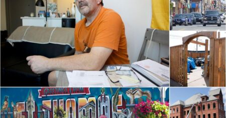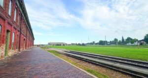


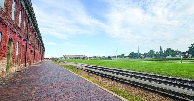
People in St. Thomas got a sneak peek at what the lands around the historic CASO station might look like over the next 25 years.
City officials shared various options with residents during a public information session at CASO station on Wednesday, Aug. 26.
The city is working on a master plan to shape future developments in the railway lands and central area of the city over the next quarter-century.
Housing Accelerator Fund Coordinator Brandon Sloan discussed these plans with an audience, mentioning that they are driven by St. Thomas’s expected growth by 2051.
During the presentation, staff pointed out that the city’s population is projected to rise by about 34,500 people, bringing it to a total of 79,500; job opportunities are also set to increase by approximately 15,800 positions, resulting in a total workforce of 38,600 by 2051.
The plan will also help redevelop known or suspected brownfields (contaminated land) within the railway lands.
Three scenarios were showcased at the meeting: maintaining the current state with moderate intensification; a high mixed-use and connectivity option; and a hybrid intensification scenario featuring zoning for residential and mixed-use high-rise buildings.
Visuals of these proposed designs can be found on the city’s project website, “Speak Up, St. Thomas.”
Status quo
Centre Street would be extended south to Wellington Street as public access to nearby lands. The city would continue primarily commercial land use along Talbot/First Avenue/Wellington Street.
Additions would include new medium-rise residential and mixed-use zoning for vacant lots and some development areas while allowing low-rise mixed-use on part of Ross Street and Princess/Centre Street with others remaining unchanged.
A new central park area and green corridor would be built along Centre Street extension alongside an updated rectangular Jonas park and a slight expansion of the skate park zone.
An active transportation corridor running east and west through these lands would connect one entry point from Talbot Street.
This scenario could accommodate between 475 to 1,325 new housing units leading to a population growth ranging from 800 to 2,300.
High mixed use
Centre Street would be extended east toward CASO crossing as a public road. New public streets designed in a grid layout would link into existing roads within the central railway lands area.
The city plans for mixed use along all of Talbot Street as well as additional sections of Wellington Street, Princess Avenue, and Moore Street. They aim to take advantage of larger vacant parcels for high-rise mixed-use or residential buildings that provide new homes or various uses supporting local businesses.
Jonas Park would transform into a central park square featuring green space in front of CASO building alongside an expanded skate park and creating a new public square at Ross and Talbot intersections.
An active transportation corridor running east-west through these areas will feature one connection point from Talbot street too.
This approach could yield between 2,300 to 3,550 new housing units leading up towards population increases from around 3,800 up until six thousand people altogether!
Hybrid intensification
No extension for Centre street here! Instead there’s going be brand-new public access route coming directly from CASO Crossing straight onto widened Jonas street linking up eventually connecting back down towards Wellington street properly!
The city intends on having plenty more opportunities available via utilizing all sorts types including mixing usage right along every inch possible across talbot street predominantly heading towards Balaclava st/CASO crossing indeed! Plus don’t forget about those big empty spaces being used wisely-high rises stacked tall plus either medium rise multi-family living arrangements added too greatly expanding housing choices further benefiting our community overall!
Pushing forward maintains commercial land utilization intact situated nicely within talbot east region adjacent nearby locations like wellington/first avenue giving flexibility especially regarding first avenue properties allowing mix uses flourish freely here under different guidelines established already promoting innovation continuously thrive forward together!!
A fabulous linear park system emerging full open views enhancing accessibility links connecting seamlessly between both famous landmarks CASO Station as well as railway museum side-by-side enhancing overall experience enjoyed throughout everyone visiting regularly always feeling welcomed joining alongside friendly neighbors thus cultivating strong bonds!”
This potential outcome allows room upwards ranging anywhere around two-thousand five-hundred-to-three-thousand-five-hundred brand-new housing units achievable ultimately impacting future populations spanning four-thousand-two-hundred-to-five-thousand-seven-hundred growing steadily ahead successfully onward!
User thoughts
During interactive parts held throughout presentation attendees voiced concerns regarding shadow impacts caused specifically due involvement showcasing taller structures being put into place instead claiming “it doesn’t suit St. Thomas.”
Residents had chance providing feedback both face-to-face digitally using surveys dropping pins indicated preferred areas worth noting directly displayed maps showing interest points emphasizing desired changes needed most evidently visible there expressing clearly necessary adjustments sought after rightly so!
A report summarizing everything discussed earlier presented future steps laid out mapped back again council meeting planned scheduled take place Monday September fourteenth upcoming week ahead promptly.
Source link
Source link