





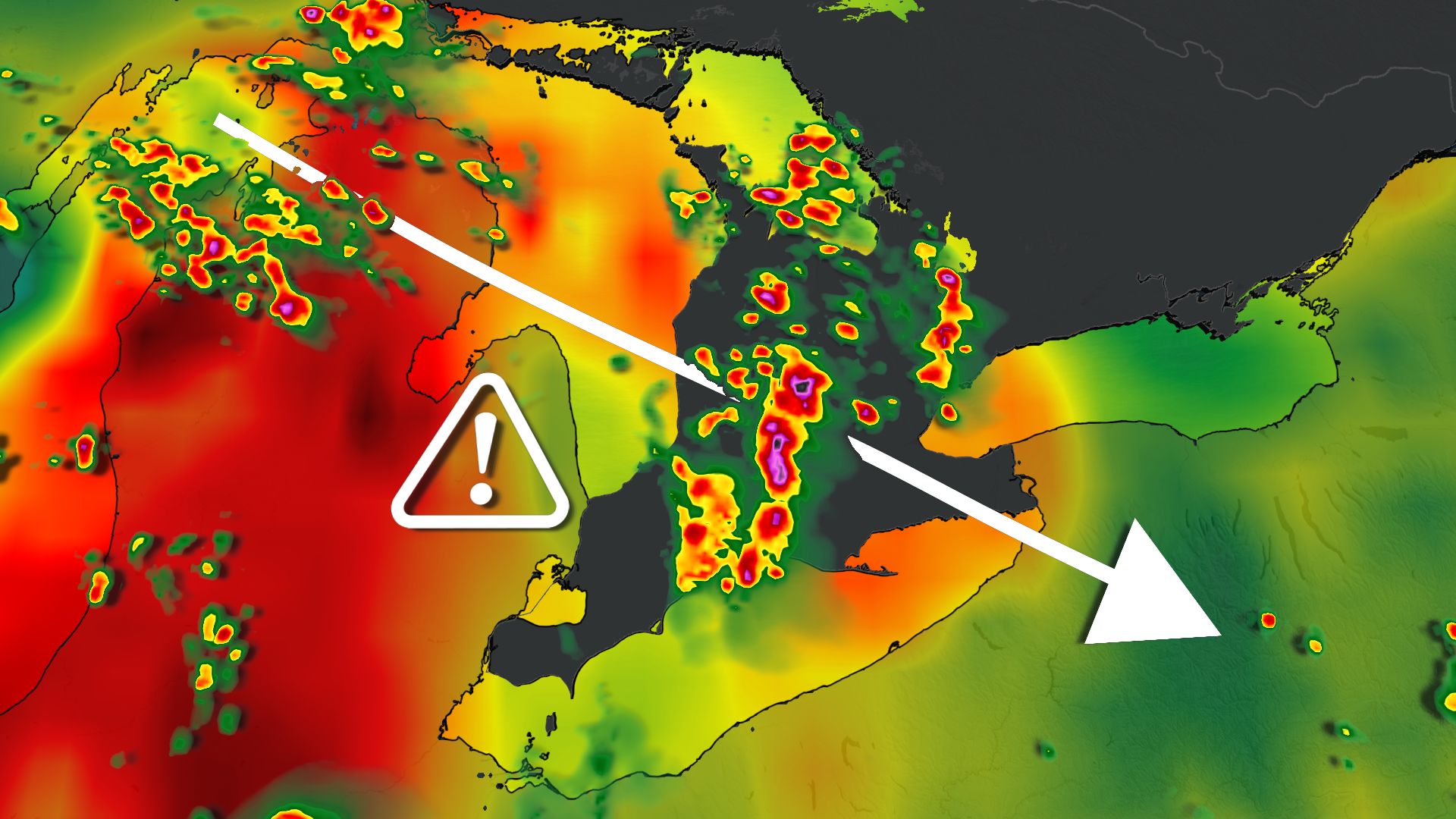
Southern Ontario is bracing for a stormy week ahead as a slow-moving weather system brings multiple rounds of thunderstorms, with some areas possibly receiving over 80 mm of rain.
The biggest concern arises if storms repeatedly pass over the same areas, causing rainfall amounts to increase quickly. Local flooding, poor visibility, and hazardous driving conditions are all likely, especially during the evening and overnight hours.
DON’T MISS: How the weather could be influencing your music taste
Source link
Storms develop throughout the day and peak overnight
Thunderstorms are expected to develop around Lake Huron and Georgian Bay counties Monday afternoon before spreading across southern Ontario. The storms will move through south-central Ontario before reaching the Greater Toronto and Hamilton Area later in the afternoon and evening. The threat will continue overnight as the low-pressure system and its cold front travel through the region. Areas experiencing consistent thunderstorms may see between 30 to 80 mm of rain, with heavy downpours, frequent lightning, and strong wind gusts possible. Southwestern Ontario will also face high humidity levels, with humidex readings nearing 40. Further east, there’s less certainty, with mainly isolated thunderstorms predicted while some regions might stay dry. SEE ALSO: 5 astronomical events happening after we’re goneFlooding risk shifts eastward into midweek
This unsettled pattern will carry on into Tuesday and Wednesday as the slow-moving low lingers over the province, shifting the main storm threat toward eastern Ontario, including Ottawa and Kingston. If warm, humid air remains present, another wave of heavy rain and thunderstorms could occur. Localized rainfall totals might again reach 50 to 80 mm when storms hit frequently, increasing flooding concerns. Showers are expected Tuesday morning with thunderstorms becoming more common throughout the afternoon. Some of the strongest storms may hit during the evening commute in Ottawa and extend into Montreal, with heavy rain possibly continuing into Wednesday.WATCH: Severe storm warnings move across southern Ontario
Stay with The Weather Network for ongoing updates for Ontario.Source link