



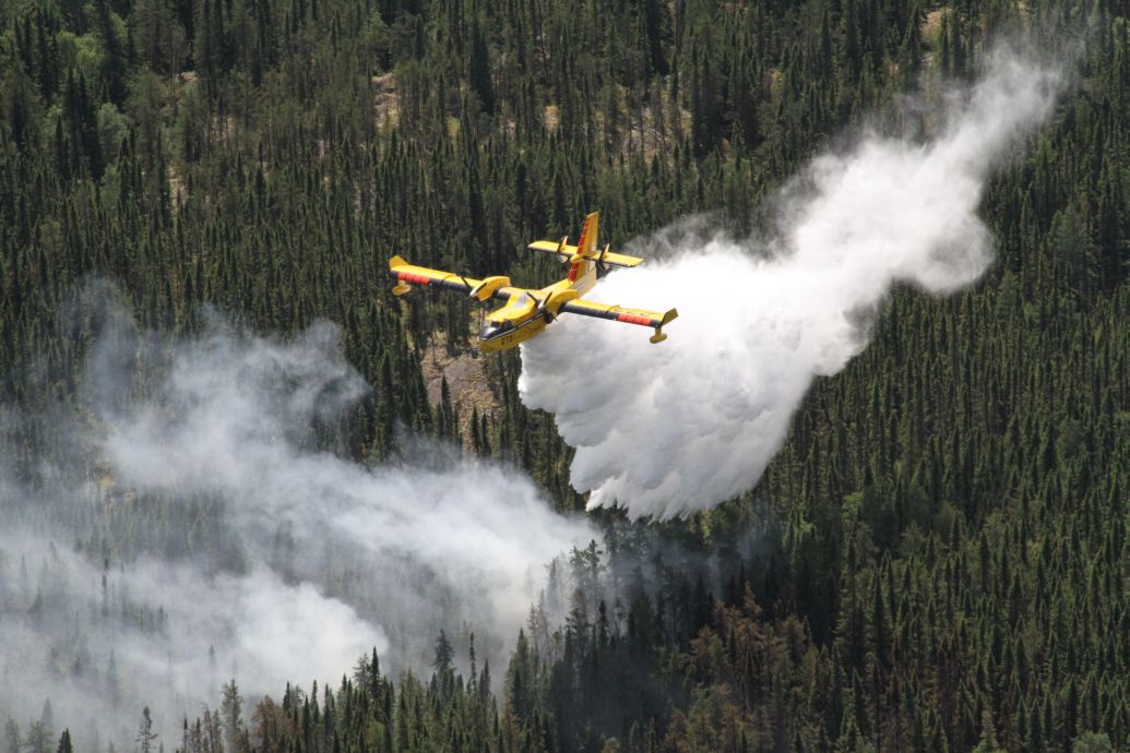
The Ministry of Natural Resources’ Aviation, Forest Fire and Emergency Services reports that the count of active wildland fires in northwestern Ontario has increased to 148.
Of these, sixty-nine are categorized as not under control.
Four fires have been declared extinguished.
MNR Fire Rangers have seen an increase in their workload with 26 new fire starts reported on Tuesday.
Map showing all new and active fires in Ontario. Courtesy Ministry of Natural Resources, July 14, 2026
Given the rise in active fires, the Ministry anticipates that additional firefighters from other areas will come to assist provincial crews shortly.
However, no further details were provided by the Ministry.
As of late Tuesday, here’s a summary of the newly identified fires and their current status;
Fort Frances 39 (FOR039) is situated across several small islands in Lac la Croix, south of Eastbend Island, along the international border. The fire spans 41.5 hectares and is currently being monitored. Sioux Lookout 90 (SLK090) is found on a small island at the southeast side of Osnaburgh Lake. This 0.2-hectare fire is not contained. Sioux Lookout 91 (SLK091) is located around 9 kilometres west of Koval Lake and about 18 kilometres northwest of Wabakimi Lake. This fire covers an area of 6.0 hectares and is being observed. Sioux Lookout 92 (SLK092) can be found on Kagami Island within the Albany River. The fire here measures at 60 hectares and is under observation. Sioux Lookout 93 (SLK093) and Sioux Lookout 94 (SLK094) are positioned between Windgo Lake and Pipestone River Provincial Park. These two fires cover areas of 7.0 hectares and 0.5 hectares respectively and remain uncontrolled. Sioux Lookout 95 (SLK095) lies about 14 kilometres east of Highway 599, southward from Jabez Lake. The size of this fire is approximately 4.0 hectares and it’s not under control. Sioux Lookout 96 (SLK096) sits roughly 2.3 kilometres southward from Rat Rapids, nestled between Highway 599 and the Albany River. This small fire measures at just around 0.2 hectares but remains uncontrolled. Dryden 37 (DRY037), located roughly about21 kilometres southeast from Ignace northwards along Highway17 spans an area measuring around1.5hectaresandisbeingheld. Red Lake24(RED024)is positioned nearly9kilometreswestof Mac Dowell Lake. This3079-hectarefireisnotundercontrol. Nipigon41(NIP041)is approximately5.5kilometresnorthof Highway11 , near Windigokan Lake. Thefiremeasuresatabout0.1hectareandisnotundercontrol. Nipigon42(NIP042)is situatedaround14.5kilometresnorthwestof Onaman Lake , adjacentto Branstorm Lake Road. Thefirecoversaareaofabout0.1hectaresandremainsuncontrolled. Nipigon43(NIP043)isapproximately8kilometreseastof South Ombabika Bay , close to Beava Creek. Thisfirecoversapproximately0.7hectaresandremainsnotundercontrol. Nipigon44(NIP044)and Nipigon49(NIP049 )arelocatedaround34.5kilometreswestof Ogoki Lake , near Mahamo Lake. Coveringareasofabout0.1and1.0hectaresrespectively , thesearealso leftuncontrolled. Nipigon45(NIP045 )hascombinedwith Nipigon46(NIP046). This1200-hectarefireisfoundnear10kilometersse outheastfrom Eabametoong First Nation(Fort Hope), between Albany Riverand Eabamet Lake. Nipigon47(NIP047 )and Nipigon48(NIP048 ) are locatedaroundfive kilometersnorthfrom Makokibatan Lake , towards Washi Lake. Covering108and52hectares respectively ; theyarenotcontained. Nipigon50(NIP050 )islocatedeastfrom Miminiska Lake, northfrom Petawanga Lake; its730-hectarearea isn’t controlledeither. Nipigon51(NIP051 ), Nipigon52(NIP052 ) plus Nipigon53( N IP053 )findthemselvesnorth from Wababimiga Lakemeasuring2.0 ,1.0, and0.5hectaresrespectively whicharenotalsoheld. Nipigon54( N IP054 )liesnorthernlyto Chipman Lakenear Kenogami Rivercoveringanarea3. hectaresthatremainuncontrolled. Finally, Nipigon55( N IP055)covers landbetween Atwoodlake&Guerin Lakesitssizeisabout1. hec ta reswhichalsoremainsuncontrolled Lastly, N ip igon56( N IP056)sitsonasmallisland nearsouthernpartofthelakek agianagami; thissmall flame coversaround30. he ct ar e sbut remains outofcontrol.
The Ministry also mentions that several ongoing fires have significantly expanded over the past day.
These include those affecting Namaygoosisagagun First Nation (Collins), Armstrong, as well as Whitesands First Nation.
Additional expanding blazes involve those near Mc Dowell First Nation, two situated within or around Quetico Provincial Park, Gakijiwanong Anishinaabe Nation along with regions bordering Ontario-Minnesota including Lac Des Mille Lacs alongside Upsala areas; also numerous incidents surrounding Mishkeegogamang First Nation along with Cat Lake.
Several wildfires inside Wabakimi Provincial Park have merged into larger ones too.
With such a multitude present, suppression efforts are strategically focused where success rates seem promising.
Operations aim primarily at safeguarding public safety alongside properties plus infrastructure concerns.
In light oft his situation, some communities faced evacuation including Armstrong, Namaygoosisagagun First Nation(Collins), Cushing Lake, Lacdes Mille Lacs First Nation, and Whitesand First Nationas well. p>Late Tuesday, s evacuations tookplacein Gull Bay. p >Residents ins everalotherregionshavebeengivenw arnings to prepare forpossibleevacuationsincluding Ignace, Cry stal La ke, andhighway633 east o f Atikokan. p >Certainparts high way59 tothemiddleof Pickle La kean d527to A rmstrongcontinuetob eclosed. p >Apartsection Highway11e astby Atikokanthathadbeenclosedon Mondaywas reopenedlate Tuesdaynight. p >Theforestfirehazardlevelfor muchoftheyregionisinextreme range. p >Itmaytakeanotherdayortwo before MNRcrewsget anyrelief. p >Environment Canada has predicted rain for this Thursdayand Friday. p >
Randy Thoms is a veteran news broadcaster with over40 years’ experience. Heisbasedin Fort Francesandcoversstoriesacrossnorthwestern Ontario. Contact Randyatthoms. randy@radioabl. ca.
View all posts
Source link