




According to the most recent report from Ontario’s Aviation, Forest Fire and Emergency Services (AFFES) released Wednesday night, there are currently 114 active wildfires in northwestern Ontario.
Out of these, 17 are not controlled, 10 are being held, three are under control, and the remaining fires are being monitored.
By Wednesday evening, three new fires were reported in the area:
Thunder Bay 75 (THU075) is located roughly 30 kilometres northwest of Shabaqua Corners, near Athelstane Lake. The fire spans 0.1 hectares and is being contained. Fort Frances 60 (FOR060) is situated about 2 kilometres west of the western edge of Fort Frances 14, close to Byers Lake. This fire is also 0.1 hectares but remains uncontrolled. Nipigon 95 (NIP095) can be found along the eastern shore of Lake Nipigon on a peninsula near Humboldt Bay; this fire too covers 0.1 hectares and is not under control.
The forest fire risk in the northwest mostly ranges from moderate to high; however, some areas face extreme hazards, particularly one near the Manitoba border and another around Marten Falls First Nation.
Significant Fires in the Region
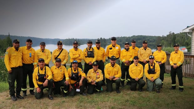
The Rinker Complex includes Thunder Bay 36 (THU036), Dryden 34 (DRY034), and Dryden 35 (DRY035). Thunder Bay 36 stands as the largest fire in the region at over 301,000 hectares and remains uncontrolled. “The Rinker Lake Complex fires have exhibited an increase in fire behaviour over the past few days,” noted AFFES. Atikokan Cluster consists of Fort Frances 14 (FOR014), Fort Frances 15 (FOR015), and Fort Frances 13 (FOR013). “An additional group of wildland firefighters from Mexico arrived on Aug. 1 to join operations,” stated AFFES. Dryden 36: Upper and Lower Moosehide Lakes show “low fire behaviour has been observed recently under favourable weather conditions,” according to AFFES. Highway 599 Cluster comprises Sioux Lookout 84 (SLK084), Sioux Lookout 86 (SLK086), and Sioux Lookout89(SLK089). “There has been no.. recent growth observed on [this] cluster of fires,” said AFFES.
Over 1,600 People Still Displaced
Around 1,653 individuals from this region continue to be evacuated due to wildfires as reported Tuesday by a spokesperson for the province’s minister of emergency preparedness and response.
In total, “14 communities have been evacuated while six have returned home.”
Since receiving its first Request for Assistance on July 14, the ministry has conducted more than 100 coordination calls with First Nation chiefs, leaders and communities along with emergency management partners across municipalities and federal government representatives according to Minister Jill Dunlop.
Ontario’s emergency preparedness minister Jill Dunlop provided updates regarding the wildfire situation in northern Ontario during a news conference at Toronto’s Ontario Emergency Management Headquarters on July 20,(Evan Mitsui/CBC)
“The number of evacuees is reported into the Provincial Emergency Operations Centre (PEOC) by community leadership. Evacuation numbers may fluctuate as community leadership confirm the total number of evacuated community members with the ministry,” wrote spokesperson Julia Facca last Wednesday.
Eabametoong First Nation started sending evacuees back home from Niagara Falls last Friday.
Meanwhile, other communities like Gull Bay First Nation urge residents who haven’t left yet to do so quickly.
“I would not ask you to leave your home or our land if it were not truly necessary. But for your own safety-and for our community’s safety-please leave now,” Gull Bay’s Chief Wilfred King mentioned in a community notice last Wednesday.
Evacuation Orders in Place
The following areas remain under evacuation orders or alerts:
If you’re under an evacuation order you must leave; if you’re under an alert you should prepare to evacuate.
A restricted fire zone exists across northwestern Ontario alongside a small portion of northeastern Ontario where open-air burning-including campfires-is prohibited.
Notice to Air Missions or NOTAMs have also been issued for Thunder Bay 36 and Fort Frances 14.
The Ministry of Natural Resources’ Thunder Bay-Ignace District updated implementation orders affecting areas near Fort Frances 14 as of Aug. 1 meaning travel restrictions apply within that specific area.
Highway Closures Currently Active
The province’s interactive highway map indicates that several roads remain closed due to wildfire activity:
All lanes are shut down both ways on Lac des Mille Lacs Road between Inwood Road and Highway17. Highway811 is closed except for local traffic leaving that area. Highway527 is closed both ways between Tertiary Highway811and Armstrong.
The Ontario Provincial Police(OPP) advise everyone for their safety-and emergency responders’ safety-to:
Stay clear from affected locations; avoid going near wildfire sites for photos or videos. Remain calm while following all evacuation orders plus instructions issued by local authorities. Avoid unnecessary travel within impacted regions. Keep updated through official sources regarding information and evacuation updates. Stay away from evacuated zones until officials confirm it’s safe again. Help maintain clear roadways so that emergency personnel can operate effectively.
If evacuating please take essential medications identification important documents mobile devices chargers along with items needed for family members or pets.
Status Update on Mail Delivery
Mail delivery services have been halted in these communities due solely because wildfires: p >Gull Bay. Armstrong Station(evacuated). Collins(evacuated).