





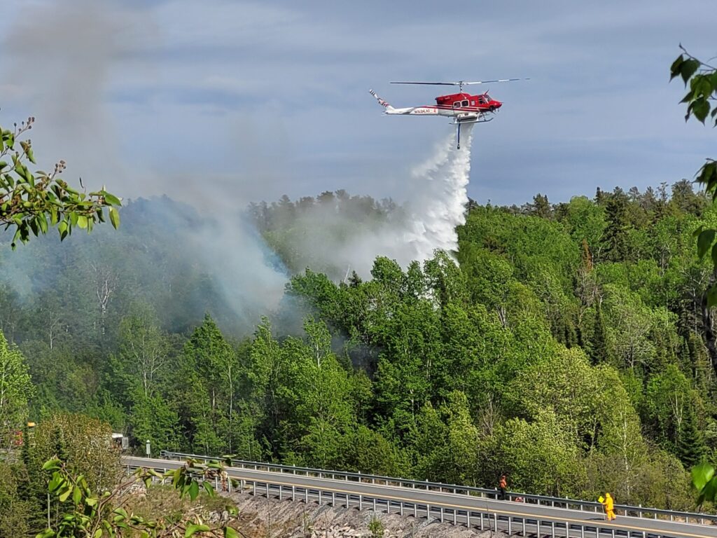
Two communities in northwestern Ontario are being evacuated due to the risk of forest fires, while another is under alert.
Provincial Police have announced that mandatory evacuation orders are in place for residents of Armstrong and the nearby Whitesand First Nation.
Several fires are currently raging nearby, sending smoke into these two communities.
The largest fire has been active near Collins since late May, scorching more than 14,000 hectares.
Emergency teams are present in the communities to help with evacuations.
At the same time, Ignace is being monitored due to what the OPP describes as a developing situation.
No further details were shared.
The Ministry of Natural Resources reported 31 new wildland fires on Monday.
These include
Fort Frances 38 (FOR038) located north of Hwy. 11 near Duck Lake, about 26 kilometers east of Atikokan. This 5.0-hectare fire received air support on July 13 and remains uncontrolled. Fort Frances 37 (FOR037) found north of Crooked Lake in Quetico Provincial Park, approximately 61 kilometers south of Atikokan. The 5-hectare fire is being monitored. Fort Frances 36 (FOR036) situated near French Lake, around 36 kilometers east of Atikokan. This small fire covers an area of 0.2 hectares and is contained. Sioux Lookout 89 (SLK089), positioned near Hill Lake about 19 kilometers north of the Ojibway Nation of Saugeen. This fire spans over 55 hectares and is not under control. Sioux Lookout 88 (SLK088) located near Doghole Lake roughly 8 kilometers southwest of Mishkeegogamang First Nation. The fire covers an area of 0.2 hectares and remains uncontrolled. Sioux Lookout 87 (SLK087), found on an island on Lake of Bays approximately 40 kilometers southeast of Sioux Lookout. This small fire spans only 0.2 hectares but is out of control. Sioux Lookout areas include Sioux Lookout 86 (300 hectares) and Sioux Lookout 85 (0.3 hectares), both situated close to Pashkokogan Lake about18 and22 kilometers south of Mishkeegogamang First Nation respectively. Sioux Lookout Fire SLK084 is located by De Lesseps Lake approximately71 kilometers south from Mishkeegogamang First Nation; it has reached143hectaresandisnotundercontrol. Dryden area includes Dryden36(DRY036), which can be foundnear Lower Moosehide Lakearound21kilometerssouthwestof Ignace; the60hectarefireisstillnotundercontrol. Dryden35(DRY035)islocatednear Weaver Lakeabout72kilometersnorthof Upsala. Thefireisnotundercontrolat500hectares. Dryden34(DRY034)islocatednear Harmon Lakearound28kilometerssouthof Allanwater Bridge. The400hectarefireisstillnotundercontrol. Dryden33(DRY033)isonthepeninsulasouthern Eagle Lakeapproximately11kilometerssouthwestof Migisi Sahgaigan First Nation. Asmall3hectarefireisalsostilluncontained. Dryden32(DRY032)wasadjacentto Hwy647nearth Blue Lake Provincial Park. Thefirehasbeenreportedextinguishedat0.1hectares. Thunder Bay59(THU059)isfoundalongthenorthernshoreof Lake Nipigonabout35kilometerseastfrom Armstrong. Theremainsafirethat’suncontrolledat0.2hectares. Thunder Bay58(THU058)islocatedabout2kilometerssouthfrom Pallisades Rd. nearthejunctionwith Moore Rd. This1-hectarefirewasattackedbyaircraftthisafternoonandremainsunchecked. Thunder Bay57(THU057)isapproximately5.5kilometersnorthof Whitefish Lake. Thefiresizeisincreasingtowardshalf-a-hectarebutremainsuncategorizedascontrollable. Thunder Bay56(THU056)-justnorthof Upsaloin Wawanglake-reached400hecatreswithoutanysignsofcontainmentyetseen. Thunder Bay55(THU055)-foundin Wabakimi Provincial Park-nearest Smoothrock Lakeabout37km northwestfrom Armstrong, andcovers5hecatres. Thunder Bay54(THU054)-nearest Brett Lake-approximately59km west from Gull River First Nation-the400 hectare-fireisalsoamongthosethatarenotcontrolled. Also noted are Thunder Bay53(which extendsover1 hectare), Thunder Bay50(which measures25 hectares), and Thunder Bay49(at a mere.1 hectarenearthewest Caribou Lakeregionpartof Wabakimi Provincial Park) Finally available dataincludes Thunder Bay52(THU052)eastboundfrom Wabakimi Provincial Parkapproximating37klm northwardinto Armstrongremaininguncontainedbeyond0.1 hactares Lastly, Nipigon40(NIP040)locatedclose Opichaun Lakesituatedabout42klsouthwardsfrontrichfort Hope. First Nation. thepresentfiresizelargestasanarea reachingoverone hectare with no containment strategiesviable yet imposed. Nipigon39-representing15decimals-closelyfollowedby38measuring75 decimalssupportspreviousfindingsregardingheatupwardtrendsinregionalclimaticchallengesincludingagrowthmonitoringobservationstrategyfortheseareasactivelybeingconsidered.
As for Monday night’s count, there were128activefiresacrossnorthwestern Ontario.
Of those, fifty-threearenowclassifiedas not under control while63remainsubjecttoclosedmonitoring, since they pose no immediate threatto public safety or property at this moment.
Randy Thoms is a veteran news broadcaster with over40years’ experience. Heisbasedin Fort Francesandcoversstoriesacrossnorthern Ontario. Contact Randyatthoms. randy@radioabl. ca.
View all posts
Source link