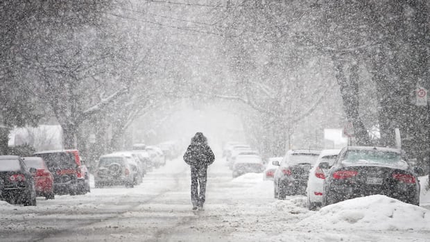
Residents in parts of Ontario, Quebec, and some regions in the Maritimes should prepare their shovels and hats as a weather system is expected to bring between 10 to 60 cm of snow across these provinces over the coming days.
In northern Ontario, Environment and Climate Change Canada has issued a winter storm warning starting Wednesday, predicting up to 60 cm of snow in certain locations.
The storm is “already wreaking havoc in northern Ontario. Already snow is falling from many parts and some routes are already closed,” said warning preparedness meteorologist Gerald Cheng during a media briefing Wednesday afternoon.
This warning, combined with poor visibility on roads due to heavy wet snow, led to rural school closures and canceled buses in the Thunder Bay area on Wednesday.
The Ontario Provincial Police reported multiple highway closures in northern Ontario and advised drivers to avoid traveling unless absolutely necessary. Some of the closures included Highway 144 near Timmins, Highway 11 (Trans-Canada Highway) near Hearst, east of Thunder Bay, and part of Highway 631 from White River northward toward Hornepayne.
The warning indicates peak snowfall rates could reach four centimeters per hour, with nearly zero visibility expected due to heavy snowfall coupled with strong winds.
“Strong northerly winds gusting up to 70 km/h will accompany the snow,” the warning stated. “Travel will likely be hazardous. Road closures are possible.”
The winter storm warning extends from Lake la Croix along the northern shore of Lake Superior, northward to Moosonee and James Bay’s tip, then east into Quebec around Lake Mistassini.
Where the winter storm warning ends in Quebec at present, there’s a special weather statement advising people in areas like Manic, Baie-Trinité, Sept-Îles-Port-Cartier, and Labrieville that snow is expected from Wednesday night into Thursday evening with up to 15 cm possible.
During the same press conference, Cheng noted that Environment and Climate Change Canada is introducing a new color-coded alert system. Under this system:
Yellow will be most common for when weather impacts are considered moderate, localized or short-term. Orange will be less frequent for when weather impacts are major or widespread possibly lasting several days. Red will be rare for when weather impacts are extensive or prolonged.
“Our banners on our website and app will match the alert color; they’ll include new alert names along with shape icons appearing in priority order,” Cheng explained. “And if we upgrade to red alerts you’ll always receive a notification via our Weather CAN app.”
WATCH | Yellow, orange and red: Learn about the new weather warming system: How Environment Canada’s new weather warning system works
Environment and Climate Change Canada has revised how it classifies its weather warnings. CBC Meteorologist Ryan Snoddon explains it’s all about risk and impact.
Source link
 How Environment Canada’s new weather warning system works
Environment and Climate Change Canada has revised how it classifies its weather warnings. CBC Meteorologist Ryan Snoddon explains it’s all about risk and impact.
Snowfall and High Winds Forecasted for Southern Ontario
Meanwhile in southern Ontario, this weather system is anticipated to deliver both snow and strong winds from Windsor all the way to Kingston. <p"We also have strong winds associated with this system-it's not just about snow here in the south," Cheng mentioned. "We’re looking at gusts reaching up to 90 km/h along Lake Erie’s shores as well as northeastern Lake Ontario." “Due to these strong northwest winds especially , they’ll stir up lake effect snow. “ Lake effect snowfall is anticipated across Huron , Grey , Bruce , Simcoe , Wellington , and Waterloo counties. A snow squall watch has been issued for expected snowfall overnight Wednesday through Thursday even extending into Friday-with accumulations potentially reaching up to 30 cm; those closer toward Lake Huron might see as much as 50 cm. “Snow squalls will move throughout Thursday before settling down by Thursday night. Strong winds may also affect some locations,” accordingto thesnow squall watch. A special weather statement covers all southern Ontario including Toronto stretching eastward towards Kingston concerning wind speeds reachingupwards of90km/h. “Local power outages could happen. High-sided vehicles may experience difficulties due towinds pushing them around. Loose items could become airborne becauseof thestrong wind,”the statementwarned.Norfolkand Haldimandcountiesalongwiththe Niagara region bordering Lake Erieareunderawindwarningstarting Wednesdayafternoon. Thewarningstateswindswill“ease”to70or80km/h Thursdaymorning.
There’s alsowindaalertinplaceforareasnear Lakeonthe Mountain Provincial Parklocatedatthenorthshoreof Lake Ontario.
Please Exercise Caution
Meteorologist Steven Flisfeder from Environment and Climate Change Canada urged everyoneto check travel conditions before setting out. “Make sure you’re taking extra precautions if you’re heading out ontheroads-keep safe distancesandallow extra timefor your trip,”Flisfeder suggested. “Travel may be challenging due tothe visibility issues so keep thatin mindif you needtobevoutontheroads Thursdaythrough Friday.”Source link


