




As of the latest update on Wednesday night from Ontario’s Aviation, Forest Fire and Emergency Services (AFFES), there are currently 108 wildfires active in northwestern Ontario.
Out of these, 10 are classified as uncontrolled, six fires are being contained, 12 are under control, and the remaining ones are being monitored.
Four new wildfires were reported in the northwest region as of Wednesday evening:
Thunder Bay 81 (THU081) is situated between Baril Lake and Cresent Lake. The fire is measured at 0.1 hectares. Thunder Bay 82 (THU082) is found near the northwest side of Greenwich Lake, around 16 kilometres east of Highway 527. This fire is also at 0.1 hectares and is currently under control. Thunder Bay 83 (THU083) is positioned north of Kitchen Road, about 6 kilometres southeast of Ruffo Lake. This fire remains uncontrolled at 0.1 hectares. Dryden 63 (DRY063) is located approximately 5 kilometres northwest of Amesdale with a size of 0.2 hectares and is under control.
The forest fire risk levels across most areas in northwestern Ontario range from low to moderate; however, certain southwestern parts, including the Thunder Bay and Kenora districts, exhibit significant high hazard zones.
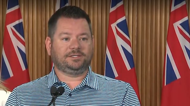
“In recent weeks, Ontario has been tackling several complex fires, especially in the Quetico area along the Canada-U. S. border and Wabakimi north of Lake Nipigon after a large lightning storm swept through,” said Mike Harris, minister of Natural Resources during a press conference on Tuesday.
Harris emphasized that crews, pilots, emergency responders, and support staff remain dedicated to ensuring public safety.
“We have more than 150 fire crews from Ontario supported by nearly 100 aircraft-over 80 helicopters and water bombers-working closely with partners across Canada and North America,” Harris stated.
He mentioned that in the upcoming days and weeks some partners would likely start relocating their resources back home-with some already returning to Alberta before moving out to British Columbia.
Key Fires in the Area
The Rinker Complex: Consisting of Thunder Bay 36, Dryden 34, and Dryden 35 – continues to be one of the largest firefighting operations underway. Thunder Bay 36 spans an area of approximately 301,240 hectares; Dryden 34 covers around 45,800 hectares; while Dryden 35 extends over about31 ,478 hectares-all three remain uncontrolled. An evacuation order is still active for regions impacted by these fires. Atikokan Cluster: Fires Fort Frances numbers 13 ,14 , and15 – also stay uncontrolled with sizes measuring at 25 ,279 hectares ,51 ,768 hectares , and42 ,273hectares respectively. An evacuation order is ongoing for Fort Frances14 while alerts persist for Fort Frances15and nearby areas.
Around 1 ,150 individuals remain displaced
As reported on Tuesday by Jill Dunlop, ministerof Emergency Preparednessand Responsewho joined Harrisatthe Tuesday press conference,14 communities have faced evacuations,sixhave returned home, and one communityhas started bringing its members back home.
Dunlop noted that roughly1,150 evacuees still reside within host communities throughoutthe province.
<p"To date,Dunlop mentioned that113 coordination callswith First Nation chiefs,community leaders ,emergency managementpartners, m municipalities, andfederal government officials hadbeen held."
Evacuation Orders Still Active
Evacuation orders or alerts continue for locations surrounding these fires:
If you’re under evacuation orders, you must leave immediately; if you’re receiving evacuation alerts, it’s advised that you prepare for possible departure.
“My ministry is also conducting assessment flights to document property damage and loss. Affected property owners can contact211to get informationfrom our ministry staffand support regarding next steps,”Harris said.
The ministry has been actively collaborating with Namaygoosisagagun First Nationto rebuild access roads leading into their community while engineersworkon constructingthe first bridgeto hasten progress.
Additionally, the ministry collaborateswithcamps, tourist operators, andsimilar stakeholderstryingtoreopenfor damage assessments, Harris added.
A restrictedfire zone remains imposed overnorthwestern Ontarioanda smallpartofnortheastern Ontario which prohibits any open-airburningincludingcampfires.
Notice to Air Missions(NOTAMs)have been issuedfor Thunder Bay36and Fort Frances14. Police closures aroundthese areasare activeas well however updateshaveoccurredregarding implementationorderscurrentlyappliedtoactive Thunder Bay36,56and Dryden34,35in Thunder Bay-Ignace Districton Fridayremovingareas previouslyincluded
The Ministryof Natural Resources Thunder Bay-Ignace Districthas liftedanimplementationorderforregionsnear Fort Frances14effective August12allowingtravelonroads, lakesintheseplacesagainwithoutrestriction. The province indicatedthatwildfire suppressionactivitiescontinuebutpublicsafetyconcerns relatedtowildfiresarenowresolved.
Highway Closures Due To Wildfire Activity
The province’sinteractive highway map shows closuresin place for these roads becauseofwildfire activity: P >Highway527is closedboth directionsbetween Kopka Riverand1st Avenuein Armstrong. Highway811is alsoclosed both directionsbetween Weaver Riverand Dog River Roadin Armstrong.
The Ontario Provincial Police(OPP ) recommends following guidelinesforyour safetyandon behalfor emergencyresponders :
- Stay awayfrom affectedlocations andrefrainfromattending wildfire scenesfortakingphotosorvideos.
- Remain calmandsupportall evacuationorders& emergencyinstructions put forthby local authorities.
- Avoidnon-essential travelwithinaffectedareas.
- Keepupwithofficial sourcesforcurrentinformation &evacuationupdates.
- Keep clear roadwayssoemergency personnelcan work effectively &safely.
- If evacuating, take necessarymedications, id, name documents, mobile devices& chargers plus items neededfor family &pets. UL >
Your Mail Delivery Updates From Canada Post h2 >
Due towildfireactivity maildeliveryhas ceasedin thesefollowingcommunities:
Gull Bay. Armstrong Station(evacuationorder). Collins(evacuatedorder).
A New Fire Reported In The Northeast Region
One newwildfire was confirmed inthe northeastasof Wednesday evening:
Sudbury53(SUD053)is1.2hectareslocatedaround1.7kilometres eastof Highway69, southern3kilometres southof Dodd Lake. The fire statusindicates it’sbeingheld.
Currently thereare44activewildlandfiresinthe northeastarea. Ofthisnumberone isn’t controlledtwoarecontainedthreeareundercontrolwhile38arestill monitored.Theforest firedanger rating ranges primarilybetweenlowmoderatelevels acrossnortheastern Ontario thoughcertainhighhazard pocketslinger insouthwestregionsparticularlyaround Sault Ste. Marie toward Greater Sudbury.
Aid Efforts Against Forest Fires
The ministryannouncedan additionaltotaloffundingamounting$650 milliontopurchasethreesixnewwaterbombersfive helicopters. Two hundredseventyeightnewpermanentpersonnel rolesincluding crewlead positionswillbeadded alongside increasedcompensation packages particularlytargetedtoworker firefighters as wellaspilots.
An afteractionreview willconductedevaluatingwildfireresponseaimedat improvingfutureplanningstrategies. Have includedfour Ontario Corpspartnersalongside17volunteers deployedto assist. Inadditiontothereceptioncentressesetupinthe citieslike Thunder Bay Drydentheprovince hasprovidedfollowing supplies/equipment : 312airpurifiers84replacementfilters Fiveairscrubbers7040N-95masks4676 hygiene kits80food hampers.
This equipment, suchas air purifiersair scrubbers& replacement filtersweresent acrossfive First Nations allowingthem tomaintainpresencewithincommunities. Parts includes Feed Ontario&Ontario Federation Indigenous Friendship Centreshavealso teameduptoship food suppliesdirectly toeffected evacuees. Lastly Kaministiquia&Upsalafiredepartmentsreceivedlandskid units sentby Global Medic
Source link