



Recently, some residents of London received a letter from the Upper Thames River Conservation Authority (UTRCA), informing them that their property lies within what’s called the ‘regulatory area.’
This area surrounds the Thames River and has been identified as low-lying and prone to flooding, which may mean stricter development regulations like additional permits.
The UTRCA, together with conservation authorities throughout Ontario, is currently updating maps that provide details about wetlands and floodplain boundaries.
This map update is a long-term project mandated by the province following regulations set after Hurricane Hazel in Toronto, which caused a tragic flood that claimed 81 lives.
Harris Park seen from atop the West London Dyke in Jul. 17. 2024. (Andrew Lupton/)
The central London section of the map was revised this spring, and there’s now a draft being created for two specific areas along the Thames River:
In the East: From Pittock Dam in Woodstock along the river to the city’s eastern edge. In the west: From the western city limits to near Delaware at the watershed boundary.
Property owners have questions
Erin Dolmage, a mapping expert at UTRCA, mentioned that property owners often want clarity on what it means for their homes or businesses to be in this regulatory area. Basically, it indicates that they might face more rules regarding development.
“They may have to go to the conservation authority to discuss their plans and decide if a permit is required,” she said.
This regulatory area also serves as a way to alert property owners about potential flood risks.
A lot of property owners don’t realize they’re in this regulatory area until they get that letter or see their property marked on a map. Dolmage pointed out that anyone whose land falls within these mapped areas can reach out to UTRCA for more info.
The Upper Thames River Conservation Authority’s map highlights areas near the Thames River and its tributaries that have potential flood risk. (UTRCA)
“We’ve found throughout this process that landowners are often not aware of this project,” said Dolmage. “So it’s partly about education.”
The mapping process has its quirks too. For example, it doesn’t account for upgrades made for flood protection in built areas. A significant portion of downtown west of the Thames River is included in this regulatory area all the way up to almost Woodward Avenue, covering all of Blackfriars neighborhood which suffered greatly during the 1937 flood that resulted in five deaths and damaged over 1,100 homes.
However, extensive dykes have been constructed recently to shield this area from overflow flooding from the river. Yet Dolmage noted that according to provincial regulations, such improvements aren’t considered during mapping updates.
An additional challenge is that some new information hasn’t yet been incorporated into online maps shown publicly. Dolmage mentioned UTRCA staff are actively working on adding those details.
Moreover, current weather forecasts influenced by climate change aren’t included in these maps because provincial guidelines don’t mandate them yet.
WATCH | London parks underwater following heavy rains :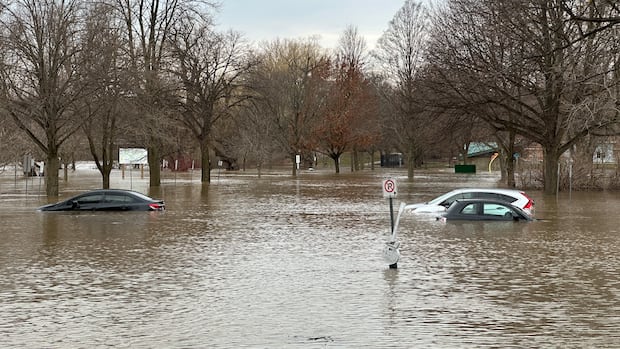
London parks underwater following heavy rains
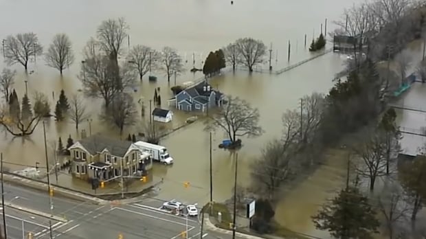
Around 55 mm of rain fell across London on Wednesday, causing water levels along the Thames River to rise and resulting in Gibbons and Harris Parks being flooded by Thursday afternoon.
“The province hasn’t given us standards for mapping climate change at this point,” said Dolmage. “It’s definitely something conservation authorities are looking at.”
Dolmage added that UTRCA can’t provide answers regarding how being part of this regulatory area might impact insurance rates or resale values-a common concern among landowners. p >
The UTRCA will hold two public information sessions focused on areas where draft mapping information exists.
Delaware Study Area Public Information Meeting: Tuesday, August 25th from 6-8 pm at Komoka Community Centre (133 Queen St., Komoka). South Thames Study Area Public Information Meeting: Thursday, August 27th from 6-8 pm at Lions Community Hall located at Flight Exec Centre (2066 Dorchester Road, Dorchester.
The public engagement process regarding these draft maps will continue through October.
For more details about mapping efforts including explanatory videos and FAQs are posted here.
Source link