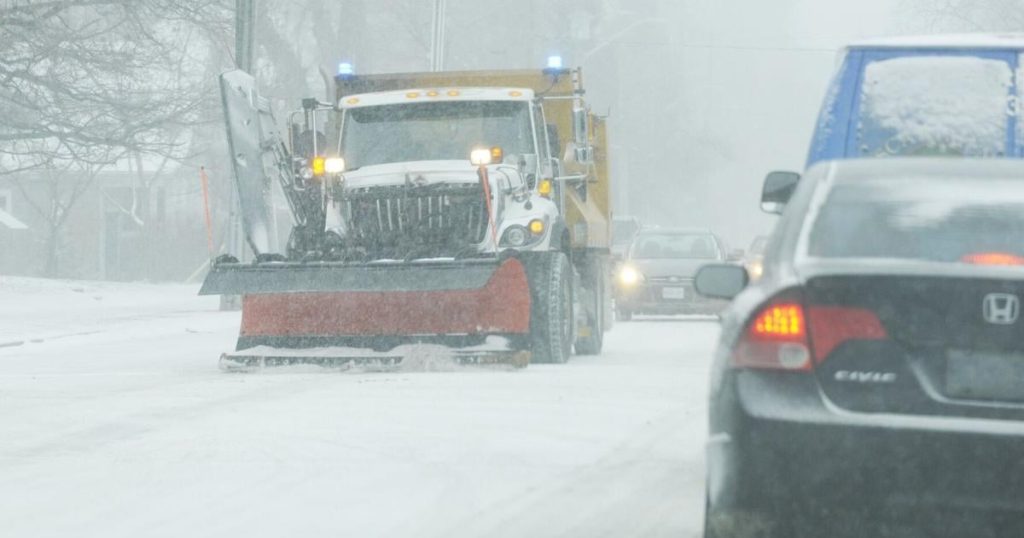
Parts of Ontario are in for a potential big blast of winter as a multi-day snow event that could last until Monday and potentially beyond blows in.
Environment Canada meteorologist Geoff Coulson said the main concern for this dump of snow remains in areas to the east and southeast of Lake Huron and Georgian Bay.
“Initially, the winds are going to be from the west,” he said. “Southern parts of the Bruce Peninsula, parts of Grey County, Simcoe County near Georgian Bay, and also areas to the east of Georgian Bay, like Parry Sound and Gravenhurst and Bracebridge — they’re going to feel the initial impact from this lake effect snow.”
What areas will be impacted and when?
Coulson said the biggest amount of snow and the biggest impacts of this system will likely remain closer to Georgian Bay and Lake Huron.
“The initial shot will likely influence areas from Parry Sound down to Gravenhurst and Bracebridge,” he said.
Coulson explained that as we get into Sunday afternoon, then into Monday, when the winds are coming from the northwest, it’s more likely places like Barrie and Orillia will see the strongest snow bands.
Coulson said both Ottawa and Toronto tend to miss out on these events.
“The best chance for flurry activity for the Ottawa area is anywhere between Thursday evening and Sunday evening,” he said.
There may be some flurries in store for Hamilton, Mississauga, Milton, Oakville and other more southern areas, but largely these areas will largely be left out of this snow event.
“Toronto will likely see some flurry activity over the course of the coming days, but it’s more northern parts of the GTA and northern parts of York Region near Lake Simcoe, areas northwest of Toronto like Caledon and Kitchener-Waterloo, could see some accumulations,” he said. “With the way these winds are blowing, it is possible that some of the lake effect from Georgian Bay could get into the Ottawa Valley.”
Who gets hit by lake effect snow?
Coulson said lake effect snow tends to be much more localized and driven by what the low-level wind is doing. Coulson explains the traditional snow belt areas in southern Ontario are closer to Georgian Bay and Lake Huron for that exact reason.
“Those are the areas that tend to get impacted the greatest from these events,” he said. “And as you go further away from later on in Georgian Bay, you can still get affected, but it doesn’t tend to be as intense as it is for areas closer to those bodies of water.”
Coulson said large-scale weather systems coming out of Texas or Colorado tend to sweep through all of southern and eastern Ontario — the impacts from those storms “are felt in some way or another pretty much everywhere.”
When will this snow event start and how long will it last?
Coulson said it looks like it the snow event will really get going late Thursday afternoon or Thursday evening and could potentially last until next week.
“This event could literally go on into Monday and beyond,” he said.
Coulson said there is concern about day after day of areas of poor visibilities. However, he said, it’s unlikely any one locality is going to experience the worst conditions day after day.
“These snow bands have a tendency to shift around somewhat,” he said. “But the models are hinting that between Thursday evening and Monday evening, there could be some areas near Lake Huron and Georgian Bay that receive in excess of 50 centimetres of new snow.”
What is the significance of this snow event?
Coulson said the event’s significance of this event comes from its juxtaposition to a relatively “quiet” fall in terms of weather and the long duration of the snow event.
“It’s been a warm fall. There hasn’t really been a lot of snow,” he said. “By late November, the snow belt areas near Lake Huron and Georgian Bay would probably already have had a few lake effect snow events to acclimatize them to winter driving conditions and just the general feel of winter.”
What is driving this intense weather?
Coulson explained this lake effect snowfall is driven by the temperature contrast between the cold Arctic air mass that’s sweeping down from northwestern Ontario, interacting with the relatively warmer and open waters of Lake Huron and Georgian Bay.
“These early season events can tend to be pretty intense because the lakes themselves are so mild, it takes a lot longer for large bodies of water to cool off than it does for a land surface,” he said.
Coulson said the temperature contrast leads to the creation of convective clouds that generate the lake effect, which can be “very energetic and can produce lots of snow.”
How do I get ready for winter driving?
Coulson encourages people to get prepared for winter driving, which includes getting snow tires on your car.
“It may be a little late to get the appointment to get the snow tires on in some cases,” he said.
Coulson said you should ensure you have an emergency kit put together and put it into your vehicle in case you do run into problems. He said people travelling, particularly in the impacted areas, should pay attention to weather and travel warnings and watches.
He also warned of “rapid change in driving conditions” closer to Georgian Bay and Lake Huron.
Top stories delivered to your inbox.
Sign Up


