





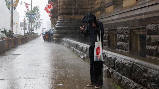
UPDATE | July 2026 wrapped up with an astounding total of 281.8 millimeters of rain recorded at the Ottawa International Airport.
This month kicked off with one of the wettest days on record for Ottawa and will finish as the rainiest month the city has experienced in over 150 years of weather tracking.
As of Tuesday, approximately 260 millimeters of rain had fallen at the Ottawa International Airport, including about 64 mm from Monday and Tuesday alone.
This surpasses Ottawa’s previous monthly rainfall record of 250.2 millimeters set back in 1899. (Environment Canada has been tracking weather data for Ottawa since 1873.)
A special weather statement was issued for much of eastern Ontario on Tuesday, with predictions estimating between 50 to 100 millimeters more rain.
Peter Kimbell, a preparedness meteorologist at Environment Canada, noted that most of that precipitation had already occurred by late Tuesday morning, which included 26.2 millimeters on Monday and another 28 millimeters measured at the airport Wednesday morning.
Although some residents in Ottawa might feel anxious due to storms and flash floods on July 1 that brought about 118mm of rain to the airport, none of eastern Ontario’s six conservation authorities have issued a flood alert related to this storm.
Cataraqui Conservation in Kingston has maintained a flood outlook since May around Lake Ontario and along the St. Lawrence River, indicating potential risks from waves and storm surges.
The areas around Deep River and eastern Algonquin Park were not included in Environment Canada’s special weather statement.
A severe thunderstorm watch remained active in western Quebec until Tuesday evening.
Source link