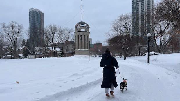
This January, Waterloo region experienced double the usual amount of snowfall.
It also marked the fourth highest snow accumulation for a January since 1998, totaling 89 cm by the month’s end.
These insights come from the monthly report at the E. D. Soulis Memorial Weather Station at the University of Waterloo.
The report indicates that snowfall since mid-November has reached record-breaking levels in the area.
“Overall for the snowfall season we have had 206.5 cm compared to the average of 95.3 cm for this point in the season,” said the report, written by weather station co-ordinator Frank Seglenieks.
WATCH | Yes, this winter has been more snowy than usual: Why does this winter feel unusually snowy?
With consistent snowfall since November, it certainly feels like a snowier winter than normal. Frank Seglenieks, co-ordinator of the E. D. Soulis Memorial weather station at the University of Waterloo, explains that so far, Waterloo region has accumulated as much snow as a typical full winter season would bring. CBC K-W talked to Seglenieks about what might happen with two months still left in winter. Reporting by Diego Pizarro and Lauren Kuivenhoven.
“This is the most snow we have had at the end of January in the history of weather records in the region, just ahead of the winter of 2008-09 by about five centimetres.”
It’s been quite a wintry season around here.
The weather station previously noted that November was particularly snowy, being recorded as having 59 cm-making it the snowiest November since 1950-with an early snowfall on Nov. 9.
December also saw colder temperatures; it was reported as being roughly three degrees cooler than average and became one of the coldest Decembers over two decades, second only to December 2017.
This January had a few warmer days early on that caused some melting but overall ended up being more than one and a half degrees below average according to reports.
“The couple of warm days in the first half of the month were more than offset by a very cold week at the end of the month. During those days, temperature went above -10°C for only a few hours and during four days it dipped below -20°C,” noted in their report.
Source link
 Why does this winter feel unusually snowy?
With consistent snowfall since November, it certainly feels like a snowier winter than normal. Frank Seglenieks, co-ordinator of the E. D. Soulis Memorial weather station at the University of Waterloo, explains that so far, Waterloo region has accumulated as much snow as a typical full winter season would bring. CBC K-W talked to Seglenieks about what might happen with two months still left in winter. Reporting by Diego Pizarro and Lauren Kuivenhoven.
“This is the most snow we have had at the end of January in the history of weather records in the region, just ahead of the winter of 2008-09 by about five centimetres.”
It’s been quite a wintry season around here.
The weather station previously noted that November was particularly snowy, being recorded as having 59 cm-making it the snowiest November since 1950-with an early snowfall on Nov. 9.
December also saw colder temperatures; it was reported as being roughly three degrees cooler than average and became one of the coldest Decembers over two decades, second only to December 2017.
This January had a few warmer days early on that caused some melting but overall ended up being more than one and a half degrees below average according to reports.
“The couple of warm days in the first half of the month were more than offset by a very cold week at the end of the month. During those days, temperature went above -10°C for only a few hours and during four days it dipped below -20°C,” noted in their report.
Ice fishing opens
The chilly weather has created suitable ice conditions at some local conservation areas allowing for ice fishing now. Ice fishing is currently allowed at: Shade’s Mills in Cambridge. Pinehurst Lake near Ayr. Belwood Lake. The Guelph Lake Conservation Area hasn’t opened ice fishing yet this season. “Conditions are being monitored closely at these locations to ensure that ice thickness meets safety requirements. When ice is too thin or unstable due to reservoir operations, then activities will be paused,” stated a release from Grand River Conservation Authority.Parks open during winter months also feature hiking trails for winter use along with cross-country skiing options and snowshoe rentals available at select parks.
You can check out which parks are open and what activities are available through conservation authority’s website.
Cold temperatures set to return
This week saw temperatures returning close to normal ranges across Waterloo region, Guelph and Wellington County; however, colder conditions are expected back over weekend. Temperatures could drop down to -19 C Friday night into Saturday , followed by -12 C during Saturday day time , and -10 C on Sunday. There’s also some sun mixed with clouds along with chances for light snow in weekend forecast. The daylight hours are slowly lengthening since astronomical winter reached its midpoint on Tuesday – marking halfway between solstice and spring equinox.Source link


