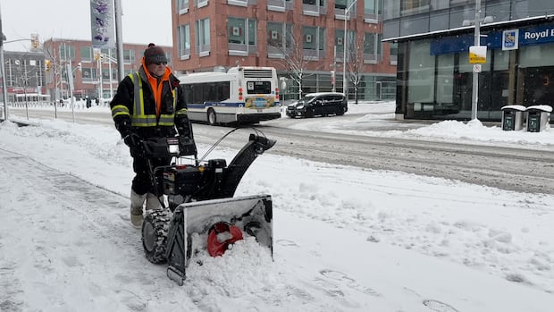
If you felt like December was chillier and snowier than normal, you’re spot on.
A recent report from the E. D. Soulis Memorial Weather Station at the University of Waterloo indicates that December was roughly three degrees colder than usual.
This makes it the second coldest December in the last 20 years, with the record for coldest held by 2017.
“There was also an interesting spike in the temperature early in the morning of [Dec.] 29 where it went from 0.8 C to 8.9 C in an hour, then down to 4.8 C an hour later and well below zero a few hours after that,” the report notes.
When it came to precipitation, there was plenty as well. Overall for the month, there were 113.2 millimetres, which exceeded the average of 72.1 millimetres.
WATCH | A storm in early December brought snow to the region: Fresh blanket of snow covers downtown Kitchener
CBC K-W’s Aastha Shetty ventured into downtown Kitchener Wednesday morning to capture how a heavy snowfall blanketed the area with thick packing snow. Environment Canada says mixed snow and drizzle were expected throughout Wednesday with up to 10 cm of snow possible. The high is predicted to be around 1 C. Overnight flurries may continue but winds will ease with a low of -9 C expected. Thursday should start out cloudy but transition into a mix of sun and cloud, reaching a high of -4 C. Snow is forecasted through Sunday.
In terms of snowfall, there were 54.5 centimetres recorded, which is significantly higher than the average of 30.7 centimetres – making last month the snowiest December since 2008. On Dec. 28, there was another mix involving rain, ice pellets, and snow that added another 50 millimetres.
“With two months of very high snowfall, the total so far this snowfall season of 113.5 centimetres is well over twice the average of 41.8 centimetres,” the report states.
Snowfall has persisted into the new year with Environment and Climate Change Canada’s forecast indicating more snow until Tuesday.
A warm spell is anticipated afterward with temperatures climbing above zero for several days.
Source link
 Fresh blanket of snow covers downtown Kitchener
CBC K-W’s Aastha Shetty ventured into downtown Kitchener Wednesday morning to capture how a heavy snowfall blanketed the area with thick packing snow. Environment Canada says mixed snow and drizzle were expected throughout Wednesday with up to 10 cm of snow possible. The high is predicted to be around 1 C. Overnight flurries may continue but winds will ease with a low of -9 C expected. Thursday should start out cloudy but transition into a mix of sun and cloud, reaching a high of -4 C. Snow is forecasted through Sunday.
In terms of snowfall, there were 54.5 centimetres recorded, which is significantly higher than the average of 30.7 centimetres – making last month the snowiest December since 2008. On Dec. 28, there was another mix involving rain, ice pellets, and snow that added another 50 millimetres.
“With two months of very high snowfall, the total so far this snowfall season of 113.5 centimetres is well over twice the average of 41.8 centimetres,” the report states.
Snowfall has persisted into the new year with Environment and Climate Change Canada’s forecast indicating more snow until Tuesday.
A warm spell is anticipated afterward with temperatures climbing above zero for several days.
Stay off ice, GRCA warns
With fluctuating temperatures, the Grand River Conservation Authority (GRCA) is advising everyone to avoid ponds, rivers or streams since conditions might be dangerous. The authority mentioned that colder weather has allowed ice formation; however many factors like daily temperature changes, wind patterns, precipitation levels and underwater currents can “greatly affect ice conditions.” “The ice can break easily and should not be used for any winter activity. Higher flows will continue to weaken ice sheets where they have formed,” stated their release on Friday. “Snow atop ice can conceal weak spots and hinder proper freezing.” No ice fishing is currently open at any GRCA parks. “Recent warm and wet weather has caused significant runoff leading to increased water levels in streams within Grand River watershed,” noted GRCA representatives.Source link


